Bharat Metro Locator

Bharat Metro Locator

Agra Metro Map 2025

Download Official Agra Metro Map (High-Res PDF)

Need an offline copy? Grab the latest Agra Metro Map PDF—perfect for printing or quick reference when mobile data drops.

📥 Download PDF (1.2 MB)

Agra Metro Map 2025 (Interactive Zoom)

Hover or tap to zoom into stations, or PDF download.

Agra Metro Map 2025Taj East GateMankameshwarTaj MahalAgra FortSikandraRaja Ki Mandi

Top Tourist Places on the Agra Metro Network

Taj Mahal

Nearest Station: Taj Mahal (Yellow Line)

Iconic UNESCO World Heritage monument.

Agra Fort

Nearest Station: Agra Fort (Yellow Line)

Historic Mughal fortress with stunning architecture.

Sikandra

Nearest Station: Sikandra (Yellow Line)

Tomb of Emperor Akbar, a Mughal masterpiece.

Mankameshwar Temple

Nearest Station: Mankameshwar (Yellow Line)

Sacred temple near Jama Masjid.

Fatehabad Road

Nearest Station: Fatehabad Road (Yellow Line)

Vibrant area with markets and hotels.

Raja Ki Mandi

Nearest Station: Raja Ki Mandi (Yellow Line)

Bustling market near railway station.

Why trust our Agra Metro map?

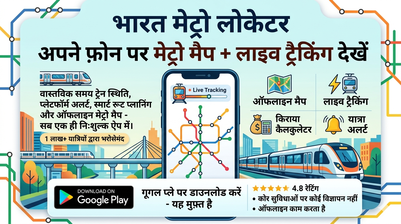
Bharat Metro Locator pulls data directly from Uttar Pradesh Metro Rail Corporation’s (UPMRC) GTFS feed and crowdsourced rider reports, ensuring accurate Agra Metro timings, fares, and station details updated nightly.

Comprehensive coverage of all lines (2025)

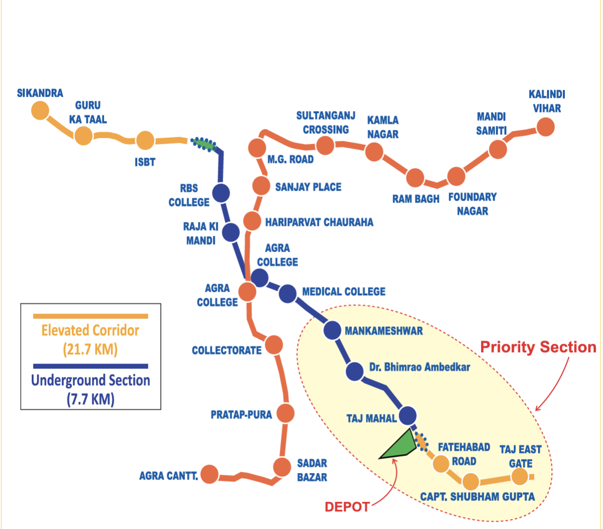
The Yellow Line (Sikandra to Taj East Gate, 14.25 km) has 6 operational stations (Taj East Gate to Mankameshwar, 5.2 km) with 14 stations planned (6.569 km elevated, 7.681 km underground). The Blue Line (Agra Cantt to Kalindi Vihar, 15.4 km, all elevated) is under construction with 15 stations, expected by 2026. Mankameshwar will serve as the interchange station.

Smart route planner

Enter your source and destination to get multiple route options ranked by travel time, interchanges, and walking distance, with a detailed Agra Metro ticket price breakdown. Use the flip arrow in the route planner to quickly check return trains (e.g., from Taj East Gate to Mankameshwar and back).

Fare calculator & smart cards

Our fare calculator includes single journey fares (INR 10–30), smart card discounts, and QR code tickets. Recharge smart cards via the Agra Metro app, UPMRC website, or ticket vending machines. Children below 90 cm travel free with an adult.

Agra Metro at a glance (2025)

  • Total route length: 5.2 km operational (Yellow Line), 29.65 km planned (Phase 1)
  • Daily ridership: ~8,000 passengers (April 2025 average, ~2.5 lakh monthly)
  • Key feature: Third rail system for efficient operations
  • Major interchange: Mankameshwar (Yellow and Blue Lines)

Agra Metro expansion updates

Yellow Line testing from RBS College to SN Medical College is ongoing, with completion expected by April 2025. Underground tunneling from Khandari Chauraha to SN Medical College is in progress, with Bijlighar Chauraha tunneling set to finish by September 2025. Blue Line construction (Agra Cantt to Kalindi Vihar) is on track for 2026 completion, with all 15 stations elevated.

Popular Metro Routes

Taj East Gate to Mankameshwar

Distance: 5.2 km | Time: 10 min | Line: Yellow Line

Plan your Agra Metro route with our smart route planner for the best travel options.

Sikandra to Taj Mahal

Distance: 12 km | Time: 20 min | Line: Yellow Line

Plan your Agra Metro route with our smart route planner for the best travel options.

Agra Fort to Fatehabad Road

Distance: 3.5 km | Time: 7 min | Line: Yellow Line

Plan your Agra Metro route with our smart route planner for the best travel options.

Raja Ki Mandi to Mankameshwar

Distance: 6 km | Time: 12 min | Line: Yellow Line

Plan your Agra Metro route with our smart route planner for the best travel options.

Real-Time Updates

As of 07:26 PM IST on Friday, July 25, 2025, the Agra Metro Yellow Line is operating normally. Recent posts on X report ~2.5 lakh monthly ridership in April 2025. Testing for the Yellow Line extension (RBS College to SN Medical College) is underway, with completion expected by April 2025. Check the Agra Metro app for live timings or service alerts.

User Reviews

"The Yellow Line makes visiting Taj Mahal and Agra Fort so easy from Taj East Gate!" - Priya M.

"The Agra Metro app’s QR ticket feature is a lifesaver for tourists!" - Sanjay R.

Exploring Agra Metro: Routes, Fares, and Map Downloads

Agra Metro, enhancing tourism in the Taj City, connects Taj East Gate to Mankameshwar on the Yellow Line. Download the Agra Metro Map PDF or use the Agra Metro app for real-time timings, QR code tickets, and smart card recharges. The 2025 Agra Metro Map covers 5.2 km with fares from INR 10–30. Explore popular routes like Taj East Gate to Mankameshwar in 10 minutes, check the Agra Metro station list, and stay updated with live status and Blue Line progress (expected 2026). With eco-friendly features like groundwater recharge and a third rail system, Agra Metro is transforming urban mobility.

Frequently Asked Questions

Where can I download the Agra Metro Map PDF?

Download the Agra Metro Map PDF from the download section on this page.

What are the Agra Metro timings for 2025?

The Yellow Line runs from 6:00 AM to 10:00 PM daily, with trains every 7–10 minutes during peak hours.

How much is the Agra Metro ticket price?

Fares range from INR 10 to INR 30; smart cards offer discounts.

How can I book Agra Metro tickets online?

Book via the Agra Metro app for QR code tickets and smart card recharges.

What is the status of Agra Metro Blue Line?

Construction is ongoing, with completion expected by 2026.