
How to compare a US Metro map with a live service alert
A map shows the network’s normal structure, while a live alert shows temporary operating conditions. Both are needed for a reliable US transit route.
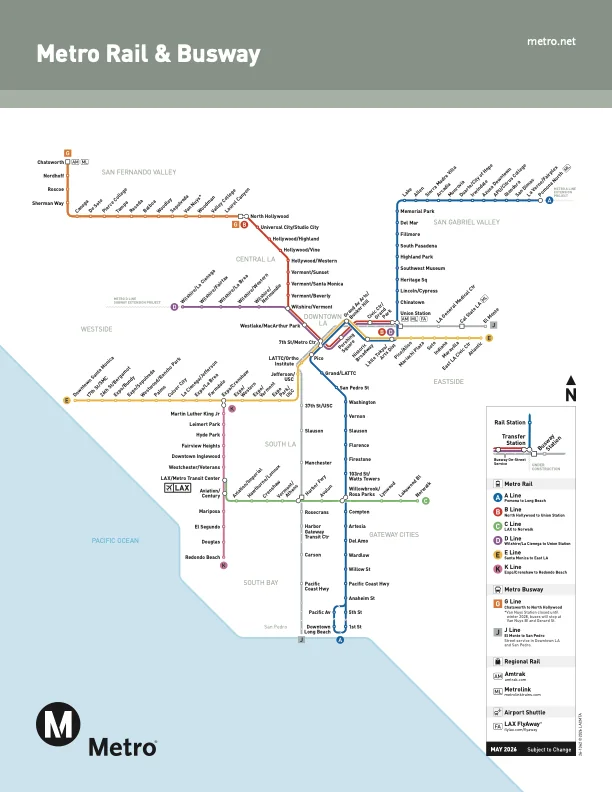
A static Metro map is useful for understanding lines, stations and transfer points. It cannot tell a rider whether a station is closed today, a train is delayed or a platform is temporarily unavailable.
What readers should know
WMATA describes Metro as a regional transportation system serving the national capital area, while its alerts page carries live service information. The same pattern applies across US transit agencies: network geography and operations are separate layers.
Practical takeaway
Start with the map to choose a route, then check the agency’s alert page for the date and time of travel. If the alert conflicts with the map, follow the current operating notice.
What riders should separate
Transit information usually has two layers: the published network map and the live operating notice. A map explains the normal route, stations and connections, while an alert may temporarily change the platform, frequency, entrance or transfer arrangement. Construction milestones also need careful reading because a project opening, a test service and regular passenger operation are separate events. The safest way to use a news update is to understand the change and then check the operator’s current advisory before starting the trip.
Planning around an alert
Read the effective date and time window first. Then check whether the notice concerns a full line, selected stations, a direction, a weekend period or a single entrance. Allow time for an accessible route, a second connection or a short walk if elevators, escalators or platforms are affected. Airport and event trips deserve extra margin because a missed connection can create a larger delay than the original service change.
Rider checklist
Save the agency’s alert page, compare it with the current map, confirm the last connection and recheck the notice shortly before departure. The focus of this guide is metro map, us transit, wmata in washington dc; exact service details should always come from the relevant transit agency.