

United States · Houston
METRORail stations
Find METRORail stations in Houston with exact source coordinates, line connections and server-rendered station detail pages.
Fare guide
METRORail fare calculator
Choose source and destination above to open a route page with the fare reference for this network. Amounts are shown in US dollars and are not converted from India's INR fare slabs.
METRORail regular fare. Free transfers require the same payment method and transfer rules apply.
Local map image rendered from the official METRO system-map PDF. METRO data terms, route/arrival attribution and trademark restrictions apply.
Source: official Metropolitan Transit Authority of Harris County developer/data page.
Transit search guide
METRORail map, stations, routes and fares
Use this Houston transit guide to find a station, check the network map, compare connected routes and open station-level fare and timing information. Searchers commonly look for METRORail map, Houston stations, METRORail route planner; the station cards below link directly to route-ready pages.
METRORail official map
Official agency map
40 stations in route data
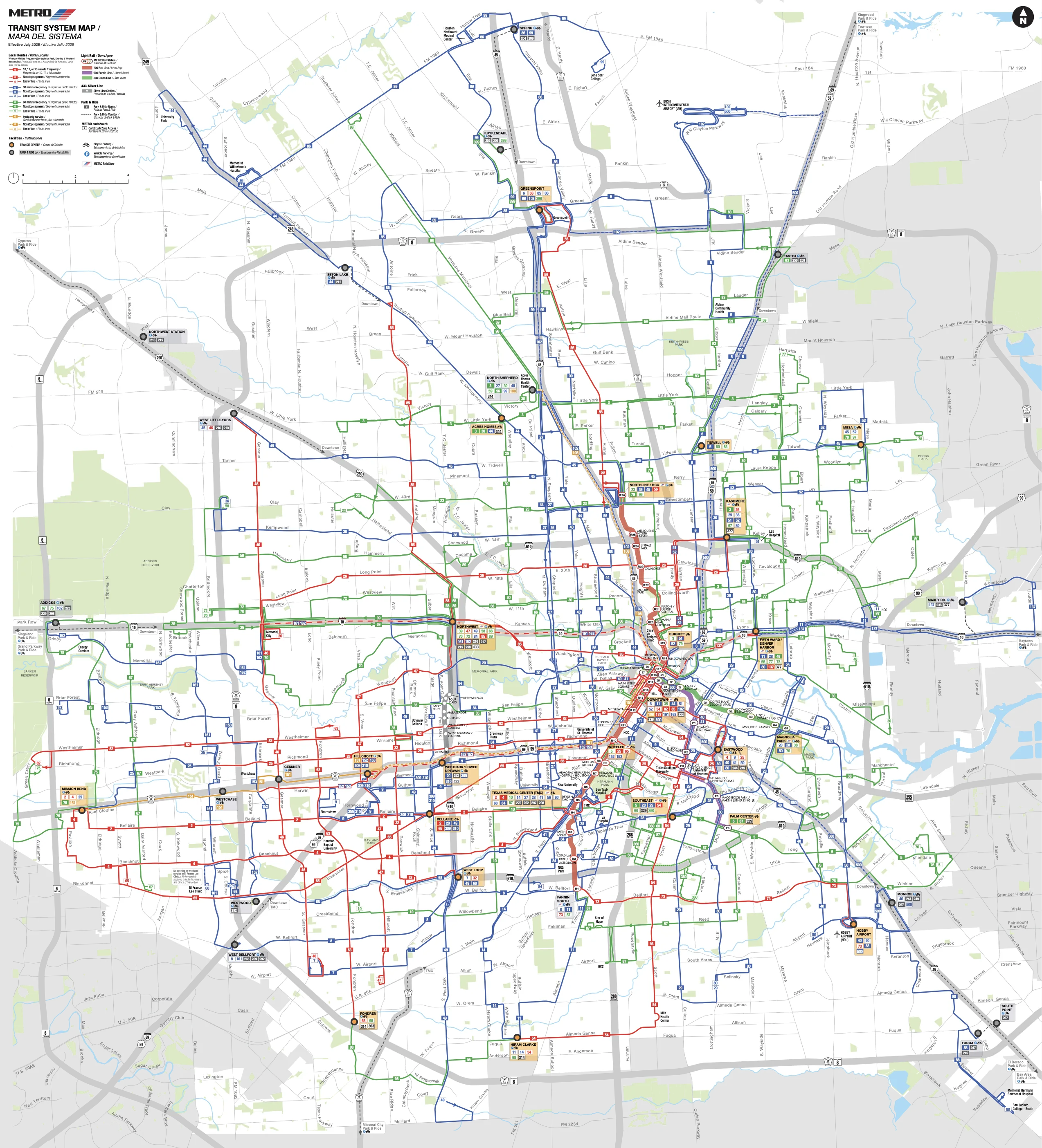
Click map or use +/− to zoom · scroll to zoom · drag when zoomed
Official network map / PDF
Source: METRORail transit agency. Route and station details remain data-driven below.
Find a route between US transit stations
Line
METRO Houston GTFS — METRORAIL GREEN LINE [800]
Line
METRO Houston GTFS — METRORAIL PURPLE LINE [900]
Line