

United States · Philadelphia
SEPTA Metro & PATCO stations
Find SEPTA Metro & PATCO stations in Philadelphia with exact source coordinates, line connections and server-rendered station detail pages.
Fare guide
SEPTA Metro & PATCO fare calculator
Choose source and destination above to open a route page with the fare reference for this network. Amounts are shown in US dollars and are not converted from India's INR fare slabs.
SEPTA Metro and bus pay-per-ride reference. PATCO and Regional Rail fares vary by origin, destination and operator.
SEPTA and PATCO developer/data terms apply. Agency logos and copyrighted map artwork are not reproduced.
Source: official Southeastern Pennsylvania Transportation Authority and PATCO developer/data page.
Transit search guide
SEPTA Metro & PATCO map, stations, routes and fares
Use this Philadelphia transit guide to find a station, check the network map, compare connected routes and open station-level fare and timing information. Searchers commonly look for SEPTA Metro & PATCO map, Philadelphia stations, SEPTA Metro & PATCO route planner; the station cards below link directly to route-ready pages.
SEPTA Metro & PATCO official map
Official agency map
170 stations in route data
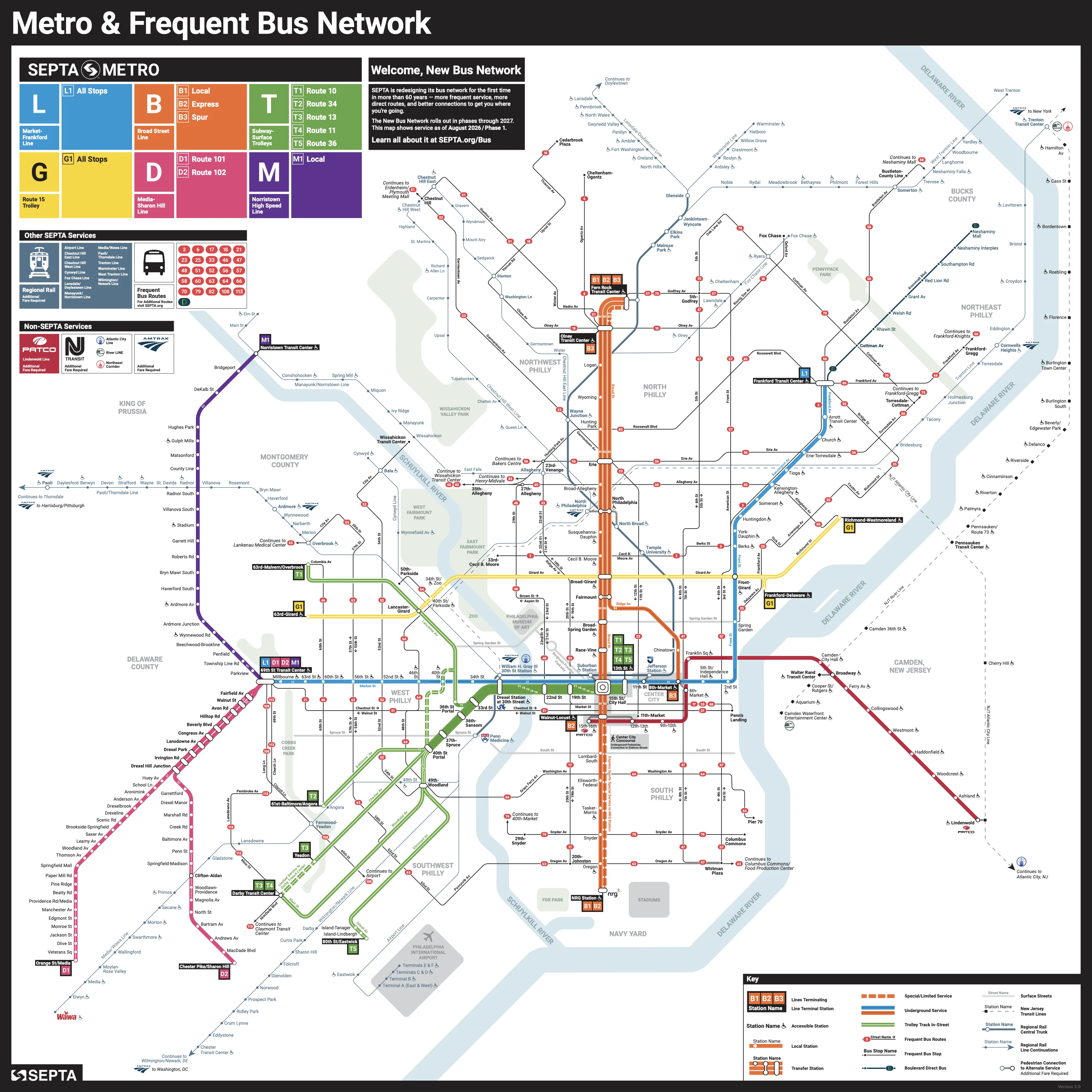
Click map or use +/− to zoom · scroll to zoom · drag when zoomed
Official network map / PDF
Source: SEPTA Metro & PATCO transit agency. Route and station details remain data-driven below.
Find a route between US transit stations
Line
PATCO GTFS — High Speed Line
Line
SEPTA GTFS — Airport Line
Line
SEPTA GTFS — Chestnut Hill East Line
Line
SEPTA GTFS — Chestnut Hill West Line
Line
SEPTA GTFS — Cynwyd Line
Line
SEPTA GTFS — Fox Chase Line
Line
SEPTA GTFS — Lansdale/Doylestown Line
Line
SEPTA GTFS — Manayunk/Norristown Line
Line
SEPTA GTFS — Media/Wawa Line
Line
SEPTA GTFS — Paoli/Thorndale Line
Line
SEPTA GTFS — Trenton Line
Line
SEPTA GTFS — Warminster Line
Line
SEPTA GTFS — West Trenton Line
Line