
Plan your metro journey
Find a route from or to World Trade Center
Choose both stations, swap the direction, or use your location to find the route, fare and journey time.
New York City Metro Station
World Trade Center Metro Station
World Trade Center is part of the NYC Subway network in New York City. Use the route planner to compare connected stations, route order and journey options before travelling.
Station search guide
World Trade Center station: map, route, fare and transit information
World Trade Center station guide for New York City: check the NYC Subway map, E, transit routes, nearby places and fare information before you travel.
World Trade Center is a E station in the NYC Subway network. Use the route finder to choose any source and destination, then open the route page for the journey path, estimated fare and travel time.
Interactive network
World Trade Center Metro Station route map
NYC Subway official map
World Trade Center selected · official network map
378 stations in route data
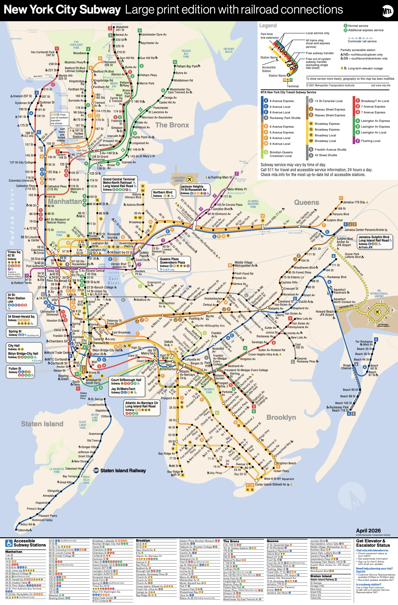
Click map or use +/− to zoom · scroll to zoom · drag when zoomed
Official network map / PDF
Source: NYC Subway transit agency. Route and station details remain data-driven below.
Explore the network
World Trade Center Metro Station: Find Route to Other Stations
Popular route choices from World Trade Center are shown below. Select a destination to view the complete route, fare and estimated journey time.
World Trade Center Metro Station information
World Trade Center is part of the NYC Subway network in New York City. Use the route planner to compare connected stations, route order and journey options before travelling.
Connected metro stations
Stay informed
Latest New York City Metro News
Navratri colours 2026 are trending in India. Here is the complete day-wise list, dates and the practical difference between a calendar colour and a l…
city-newsUS midterm elections 2026: what voters are choosing on November 3The 2026 US midterm general election is scheduled for November 3. Voters will decide all House seats and a portion of Senate seats, along with state…
explainerNavratri 2026 Dates: October 11 to 20 Calendar and Why City Timings MatterShardiya Navratri 2026 runs from October 11 to October 20 in the Delhi calendar. The date guide explains the nine nights, Ashtami, Navami and Vijayad…
explainer2026 US midterm election calendar: primaries, runoffs and the general votePrimary dates and runoff rules vary by state. The Federal Election Commission lists the 2026 congressional calendar while warning that state dates ca…
explainerHow the US House and Senate races shape the 2026 midtermsControl of Congress depends on separate House and Senate contests. The two chambers have different election cycles, district structures and majority…
World Trade Center Metro Station FAQs
Which line is World Trade Center Metro Station on?
World Trade Center Metro Station is on the E. Check the route map above for connected stations and interchange planning.
How do I reach nearby destinations from World Trade Center Metro Station?
Use the station-to-destination route planner above for the walking direction and metro connection. The closest mapped place is nearby destinations.
What is the distance from World Trade Center Metro Station to nearby destinations?
nearby destinations is approximately Check the mapped walking route from the station in the mapped local-place data. Walking access can vary by gate and road crossing.
How can I get to World Trade Center Metro Station from my location?
Choose your source station from the route planner or tap Use my location. Your browser location is used to suggest the nearest station and is not stored.
What is the World Trade Center Metro Station opening time?
Check the latest operator notice for opening and closing times.
What is the World Trade Center Metro Station ticket price?
Fare depends on the source and destination; use the route planner for an indicative fare.
What is the World Trade Center Metro route and line colour?
World Trade Center is served by the E. Use the route planner to select any source and destination station, including Badarpur Border where available.
Are there shops near World Trade Center Metro Station?
Nearby shops and services vary around World Trade Center Metro Station. Check the nearby places listed on this page and confirm business hours locally.