
Toronto · Canada
Toronto Subway Map: TTC Lines, Stations & Routes
Use the TTC route directory for Toronto subway, light rail, streetcar and bus connections. The official live map is the best source for current service alerts and route conditions.
Use the official operator source for the latest map, fares, alerts and operating conditions.
Map preview
Toronto TTC Subway map
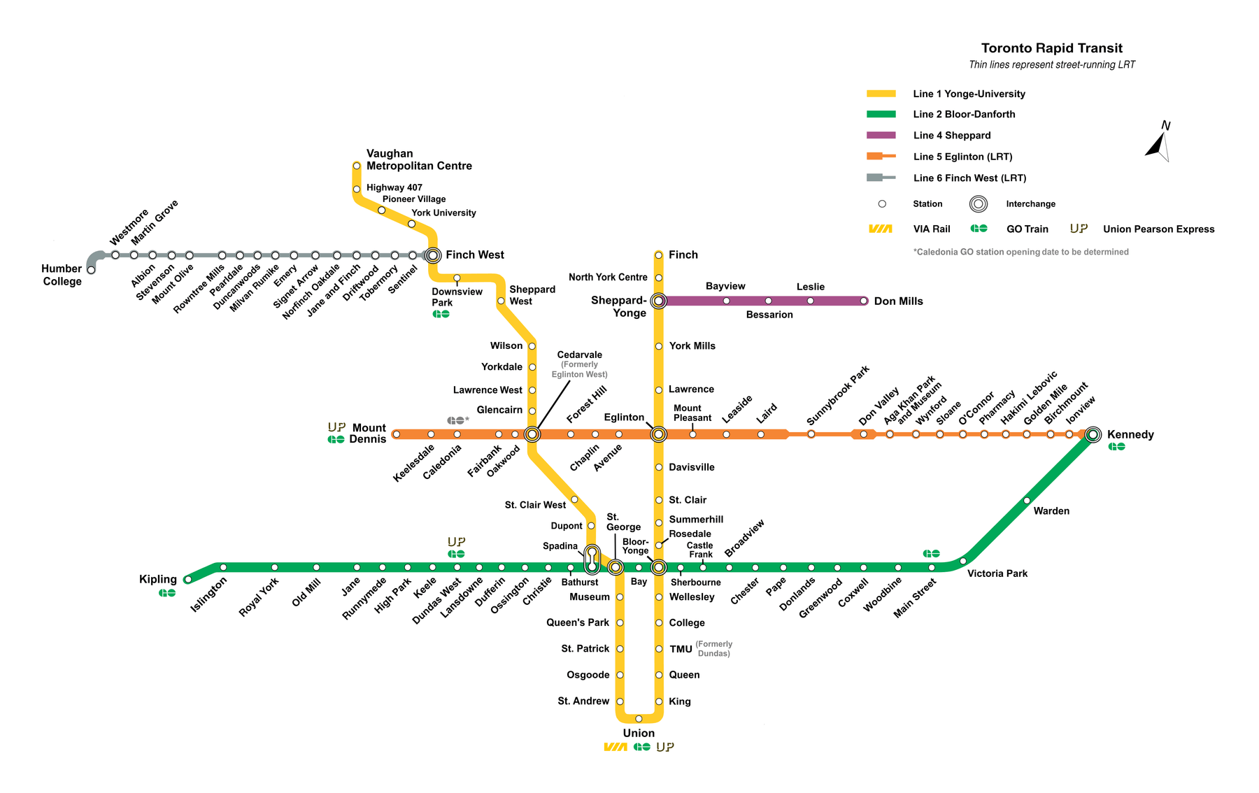
Network overview
Toronto TTC Subway lines and route map
Explore the Toronto subway map, TTC subway and light rail lines, station connections, route information and the official live map. The route page below is designed for map discovery and links directly to the operator’s current information.
Line directory
Toronto subway lines
FAQ
Toronto metro map questions
Where can I find the official Toronto metro map?
Use the official TTC Subway map link on this page. It is the source for the latest published network diagram.
How can I check live Toronto service?
Open the official route or service link on this page before travelling. Planned closures and operating patterns can change.